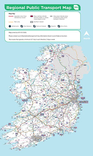
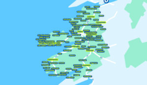
TFI Regional Public Transport Map | City Services | Dublin Airport Maps | Town Bus Services | TFI Local Link Services | Six Wild Atlantic Way regions| Ireland’s Ancient East | Ireland’s Hidden Heartlands
Explore Ireland’s regional transport network with our interactive map. It includes:
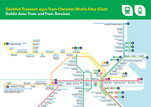
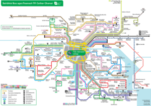
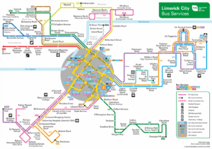
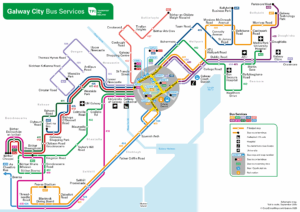
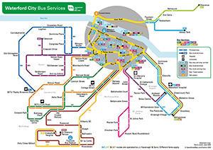
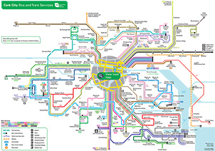
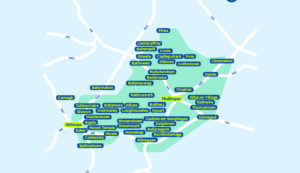
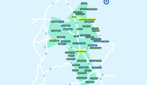
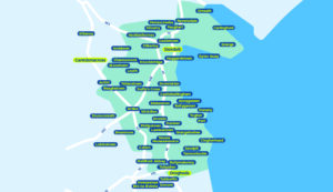
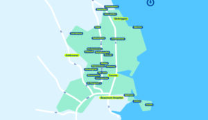
Discover public transport options in Ireland’s major cities:
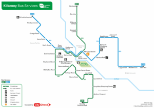
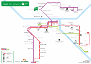
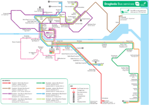
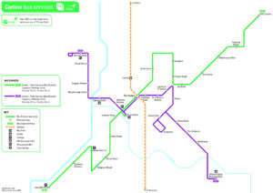
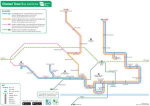
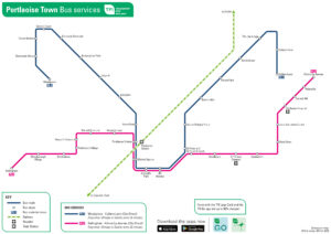
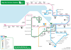
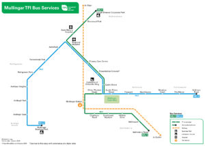
Find town bus service maps for:
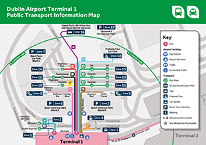
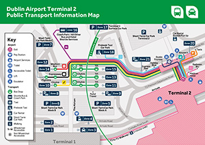
These Dublin terminal 1 and 2 maps show which bus routes go from which zones, and how to find those zones from Terminal 1 and Terminal 2.
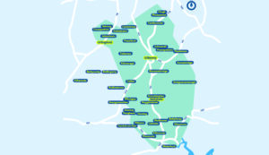
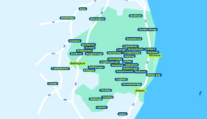
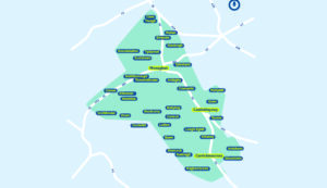
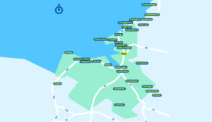
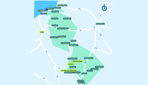
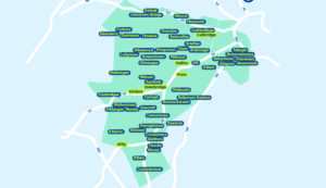
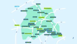
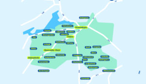
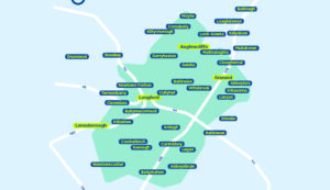
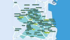
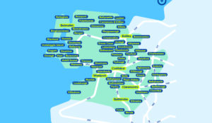
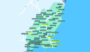
TFI Local Link offers accessible bus services across rural Ireland.
View route maps by region to find services near you.
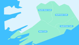
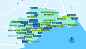
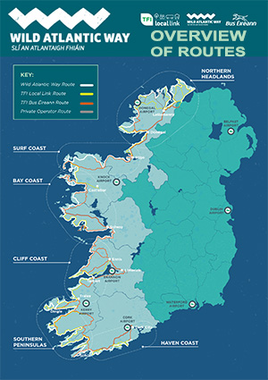
Travel the stunning Wild Atlantic Way with ease.
Our maps cover six regions along the route, showcasing:
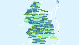
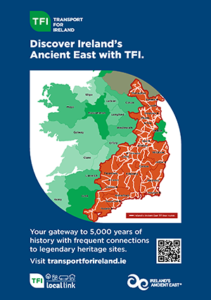
Explore Ireland’s Ancient East with TFI Local Link and discover a region shaped by history, heritage and vibrant local communities. From historic towns and ancient landmarks to scenic countryside and coastal views, there is plenty to see and do along the way.
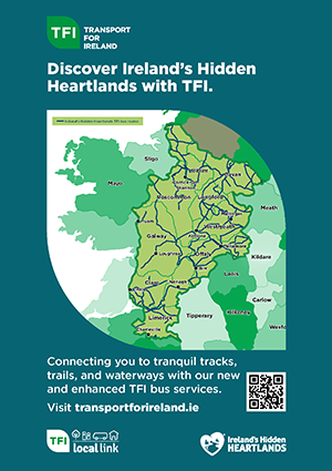
Explore Ireland’s Hidden Heartlands with TFI Local Link and discover a region of tranquil waterways, scenic landscapes and vibrant towns.
TFI Regional Public Transport Map | City Services | Town Bus Services | TFI Local Link Services | Six Wild Atlantic Way regions