Below, the maps show where to find TFI (Transport for Ireland) Bus Services to Dublin city centre and other destinations.
It shows which bus routes go from which zones, and how to find those zones from Terminal 1 and Terminal 2.
The maps also provide a guide to other bus services, Shuttle bus and Coach park, Taxi, Car rental, Short term and Long term car parks. The map keys indicate which routes are wheelchair accessible.
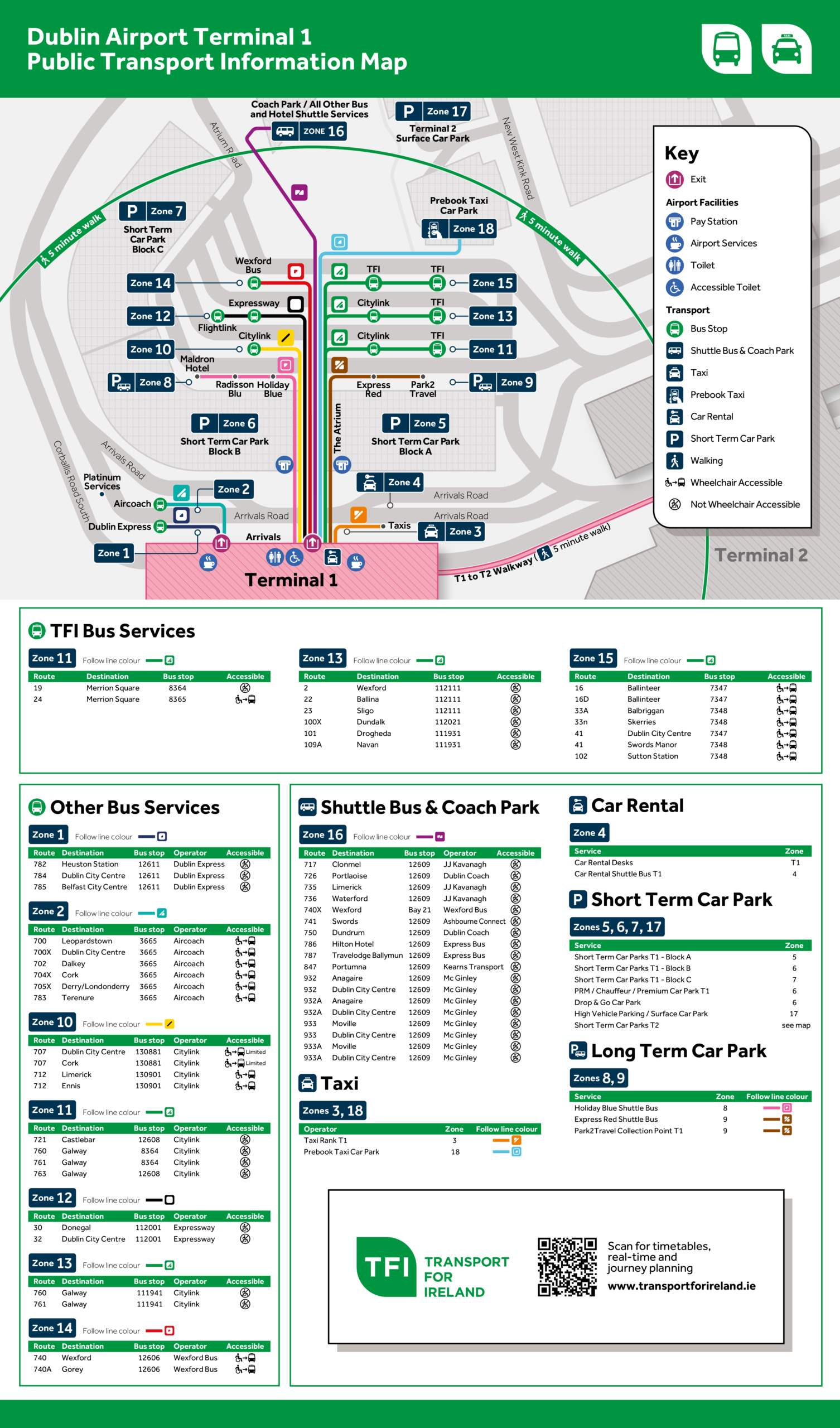
DOWNLOAD Dublin Terminal 1 – Public Transport Information Map – PDF
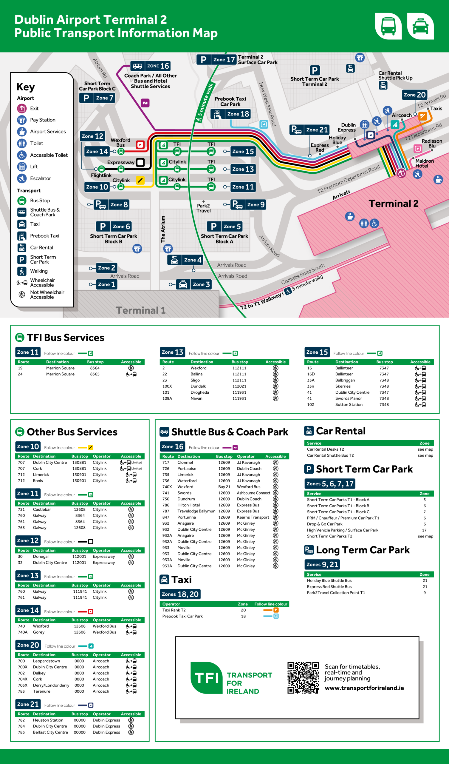
DOWNLOAD Dublin Terminal 2 – Public Transport Information Map – PDF