Docklands 5k 2026 race, Dublin, Sir John Rogerson’s Quay, 9th July
09/07/2026
09/07/2026
There will be Bus diversions due to Docklands 5k 2026 race
See below for details.
The race will take place on Thursday, July 9th, starting at 7:45pm.
Docklands 5K Race | Dublin City Council
The distance is 5k, run over a flat, fast loop in Dublin’s Docklands area.
Road closures and bus diversions will be in place – see below.
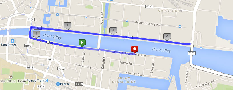
All Closures from 19:30hrs to 21:00hrs on Thursday 9th July 2026
Further information at Docklands 5K
Live Service Updates and Disruptions | Transport for Ireland
Dublin Bus – Diversions due to Docklands 5K
We wish to advise customers that due to the Docklands 5k, the following diversions will be in place from 19.00hrs until approx. 21.45hrs on Thursday 9 2026.
Routes 60, G1 and G2
Towards John Rogerson’s Quay / Spencer Dock
Normal route to Eden Quay, divert via Beresford Place, Matt Talbot Memorial Bridge, Moss Street, Shaw Street, Pearse Street and terminate.
Towards Red Cow Luas / Liffey Valley Shopping Centre
Depart Pearse Street, divert via Tara Street, and back on to normal route.
Route 151
Towards Docklands
Normal route to Eden Quay, divert via Amiens Street, North Strand, Annesley Place, East Wall Road and back on to normal route.
Towards Foxborough
Normal route.
Route N4
Towards Point Village
Normal route to East Wall Road, divert via Sheriff Street Upper and terminate at stop 7705 Castleforbes Road.
Towards Blanchardstown Shopping Centre
Depart stop 7705 Castleforbes Road, divert via Sheriff Street, East Road and back on to normal route.